
This item is no longer available.
Join The Club. Find More Fish
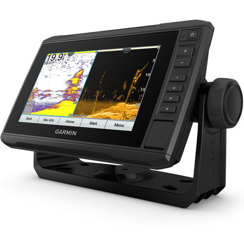
The sunlight-readable 7" touchscreen chartplotter features a quick-release bail mount and a transducer for Ultra High-Definition scanning sonar and CHIRP traditional sonar.
Take fishing to the next level
Sonar Support
This chartplotter supports a variety of Garmin transducers, including the Panoptix LiveScope scanning sonar system, which lets you see all around your boat in real time.
Included Transducer
This chartplotter comes with a GT24 transducer for Ultra High-Definition ClearVu scanning sonar, which shows you a crystal-clear image below your boat. Plus, you get Garmin high wide CHIRP traditional sonar for remarkable target separation.
Preloaded Charts
Experience unparalleled coverage and detail with preloaded BlueChart g3 coastal charts featuring integrated Navionics data. Charts cover the coastal U.S., including the East and West coasts, Gulf of Mexico and the U.S. and Canadian sides of the Great Lakes.
Quickdraw Contours
Create personalized fishing maps on-screen with 1' contours. Keep the data to yourself, or share it with the Quickdraw Community on the Garmin Connect app.
Boat connected
Network Capable
If you have multiple compatible ECHOMAP UHD or ECHOMAP Ultra devices on your boat, you can share information - such as sonar, user data and charts - among them (7" and 9" models only).
NMEA 2000 And NMEA 0183 Networks
Connect to autopilots, digital switching, weather, FUSION-Link audio system, media, VHF, AIS and more from one screen.
Activecaptain App
Built-in Wi-Fi connectivity pairs with the free all-in-one mobile app for access to the OneChart feature, smart notifications, software updates, Garmin Quickdraw Community data and more.
Force Trolling Motor Compatibility
Take control of the most powerful and efficient trolling motor available2, route it to waypoints, follow tracks and more from the screen of your chartplotter.
Engine Connectivity
Connect this chartplotter to different kinds of engines - including select Mercury and Yamaha models - to see RPMs, fuel flow, temperature, trim and other important information at a glance. You may need additional hardware, so be sure to check with your engine manufacturer.