
This item is no longer available.
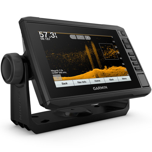
The sunlight-readable 7” touchscreen chartplotter features a quick-release bail mount and a transducer for Ultra High-Definition scanning sonar and CHIRP traditional sonar.
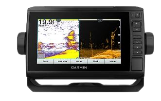
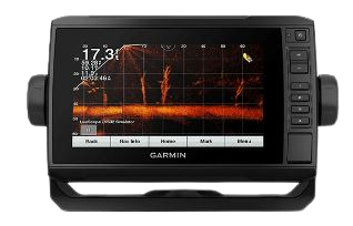
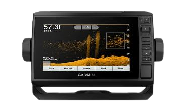
This chartplotter comes with a GT24 transducer for Ultra High-Definition ClearVü scanning sonar, which shows you a crystal-clear image below your boat. Plus, you get Garmin high wide CHIRP traditional sonar for remarkable target separation.
This chartplotter supports a variety of Garmin transducers (sold separately), including the Panoptix LiveScope™ scanning sonar system, which lets you see all around your boat in real time.
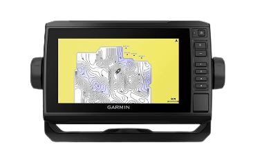
Create personalized fishing maps on-screen with 1’ contours. Keep the data to yourself, or share it with the Quickdraw Community on Garmin Connect™.

Experience unparalleled coverage and detail with preloaded LakeVü g3 inland maps featuring integrated Navionics® data that covers more than 17,000 lakes with up to 1’ contours.
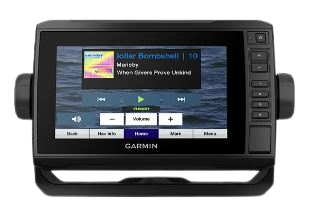
Connect to autopilots, digital switching, weather, FUSION-Link™ audio system, media, VHF, AIS and more from one screen.
If you have multiple compatible ECHOMAP UHD or ECHOMAP Ultra devices on your boat, you can share information — such as sonar, user data and charts — among them (7” and 9” models only).
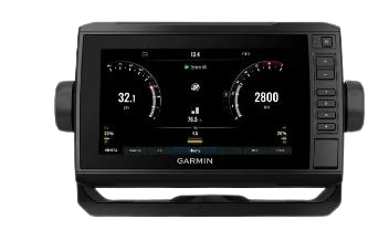
Connect this chartplotter to different kinds of engines — including select Mercury and Yamaha® models — to see RPMs, fuel flow, temperature, trim and other important information at a glance. You may need additional hardware, so be sure to check with your engine manufacturer.
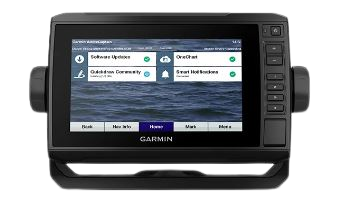
Built-in Wi-Fi® connectivity pairs with the free all-in-one mobile app for access to the OneChart™ feature, smart notifications1, software updates, Garmin Quickdraw™ Community data and more.

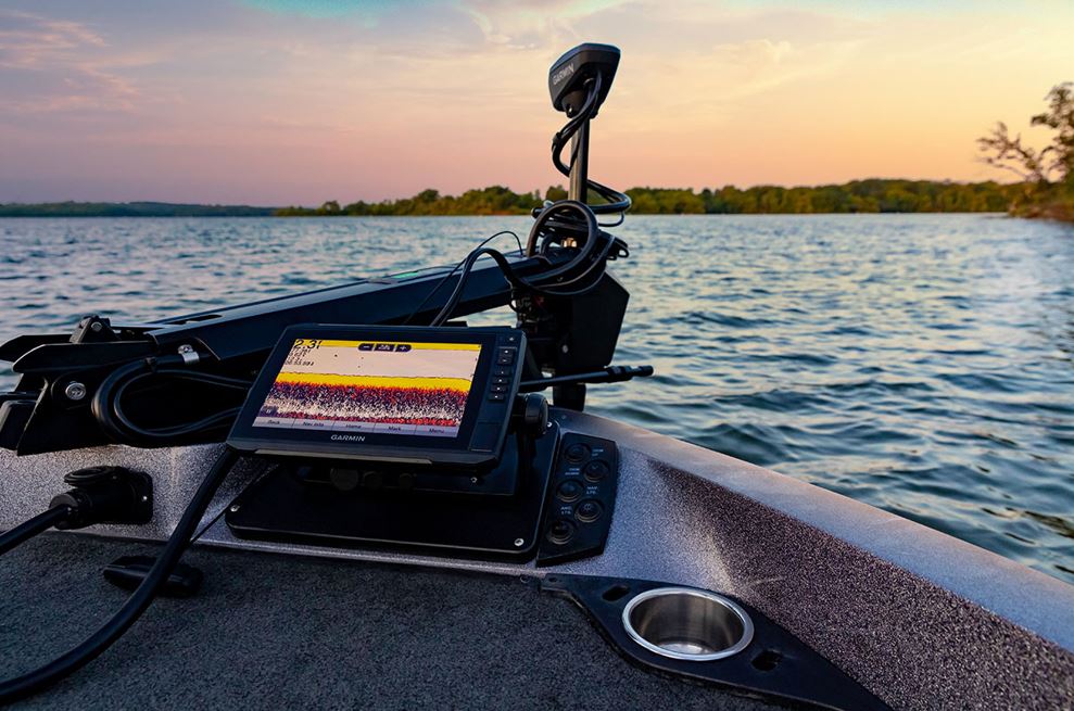
Join the Club. Find More Fish:
The sunlight-readable 7" (17.78cm) touchscreen chartplotter features a quick-release bail mount and a transducer for ultra-high-definition scanning sonar and CHIRP traditional sonar. See below your boat in incredible detail with included transducer. Navigate any waters with preloaded LakeVu g3 inland maps. Share data with other devices on your network. Manage your marine experience from nearly anywhere. Create your own maps on the fly and tailor them to fit your needs.
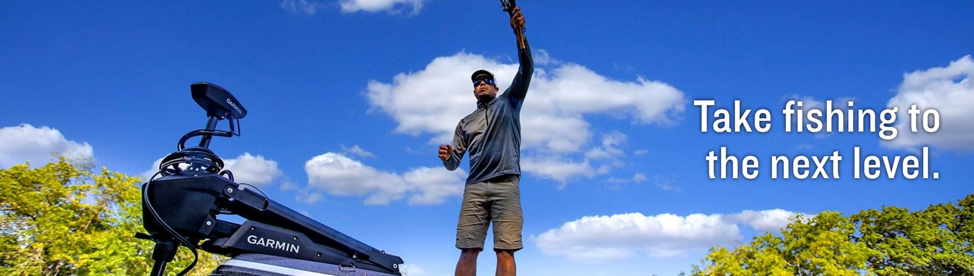
Take Fishing to Next Level:
Sonar Support: This chartplotter supports a variety of Garmin transducers, including the Panoptix LiveScope scanning sonar system, which lets you see all around your boat in real time. Included Transducer: This chartplotter comes with a GT24 transducer for ultra-high-definition ClearVu scanning sonar, which shows you a crystal-clear image below your boat. Plus, you get Garmin high wide CHIRP traditional sonar for remarkable target separation. Preloaded Mapping: Experience unparalleled coverage and detail with preloaded LakeVu g3 inland maps featuring integrated Navionics data that covers more than 17,000 lakes with up to 1' (30.5cm) contours. Quickdraw Contours: Create personalized fishing maps on-screen with 1' (30.5cm) contours. Keep the data to yourself, or share it with the Quickdraw Community on the Garmin Connect app.
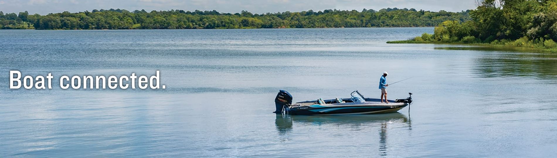
Boat Connected:
Network Capable: If you have multiple compatible ECHOMAP UHD or ECHOMAP Ultra devices on your boat, you can share information - such as sonar, user data and charts - among them. NMEA 2000 and NMEA 0183 Networks: Connect to autopilots, digital switching, weather, FUSION-Link audio system, media, VHF, AIS and more from one screen. Activecaptain App: Built-in Wi-Fi connectivity pairs with the free all-in-one mobile app for access to the OneChart feature, smart notifications (1), software updates, Garmin Quickdraw Community data and more. Force Trolling Motor Compatibility (motor not included): Take control of the most powerful and efficient trolling motor available (2), route it to waypoints, follow tracks and more from the screen of your chartplotter. Engine Connectivity: Connect this chartplotter to different kinds of engines - including select Mercury and Yamaha models - to see RPMs, fuel flow, temperature, trim and other important information at a glance. You may need additional hardware, so be sure to check with your engine manufacturer.
The Garmin ECHOMAP UHD 73cv U.S. LakeVu g3 measure 9.8" x 5.5" x 2.0" (25cm x 13.9cm x 5.1cm) and has a unit input touch screen display with keyed assist. The WVGA, NP display type measures 6.1" x 3.4"; 7.0" diagonal (15.5 cm x 8.6cm; 17.8cm diagonal) and has a resolution of 800 x 480 pixels. The unit weighs 1.7 lbs. (770 g), is waterproof with an IPX7 rating, and can be mounted bail or flush. Maps & Memory: Accepts data cards 1 microSD card; 32 GB maximum size. Has 5,000 waypoint capability, tracking points of 50,000, stores 50 saved tracks and 100 navigation routes. Sensors include a 5 Hz built-in receiver, is NMEA 2000 and 0183 compatible, with a GPS and supports WAAS.
Built-in maps include LAKEVU (inland) and (Sounder) Tide Tables. Optional map support is LAKEVU G3, LAKEVU G3 Ultra, Garmin NAVIONICS Plus, Garmin NAVIONICS Vision Plus, Sounder TOPO, Standard Mapping, and Garmin Quickdraw Contours. Chartplotter features are AIS, DSC, supports Fusion-Link compatible radios, is ACTIVECAPTAIN compatible, wireless remote compatible and has sailing features. Sonar features & specifications are display sonar, with a power output of 500 W. Traditional sonar (dual frequency/beam) built-in (single channel CHIRP, 70/83/200 kHz, L, M, H CHIRP). CLEARVU built-in 260/455/800/1000/1200 kHz, PANOPTIX sonar and LIVESCOPE. Connections (one each) NMEA 2000 port, Connections NMEA0183 input port, NMEA 0183 input (TX) port, Garmin marine network Panoptix port, and 8-pin transducer port. Electrically the unit has a power input of 9 to 18 Vdc, with a typical current draw at 12 VDC of 0.8 A, a maximum current draw at 12 VDC of 1.25 A and a maximum power usage at 10 VDC of 15W. Included in the box with the ECHOMAP UHD 73cv with LakeVu g3 for U.S. are the GT24UHD-TM transducer, power/data cable, tilt/swivel mount with quick release cradle, flush mount, protective cover, hardware and documentation.
Note:
(1) When paired with a compatible smartphone
(2) In compliance with ISO standard 13342
Wi-Fi is a registered trademark of the Wi-Fi Alliance.